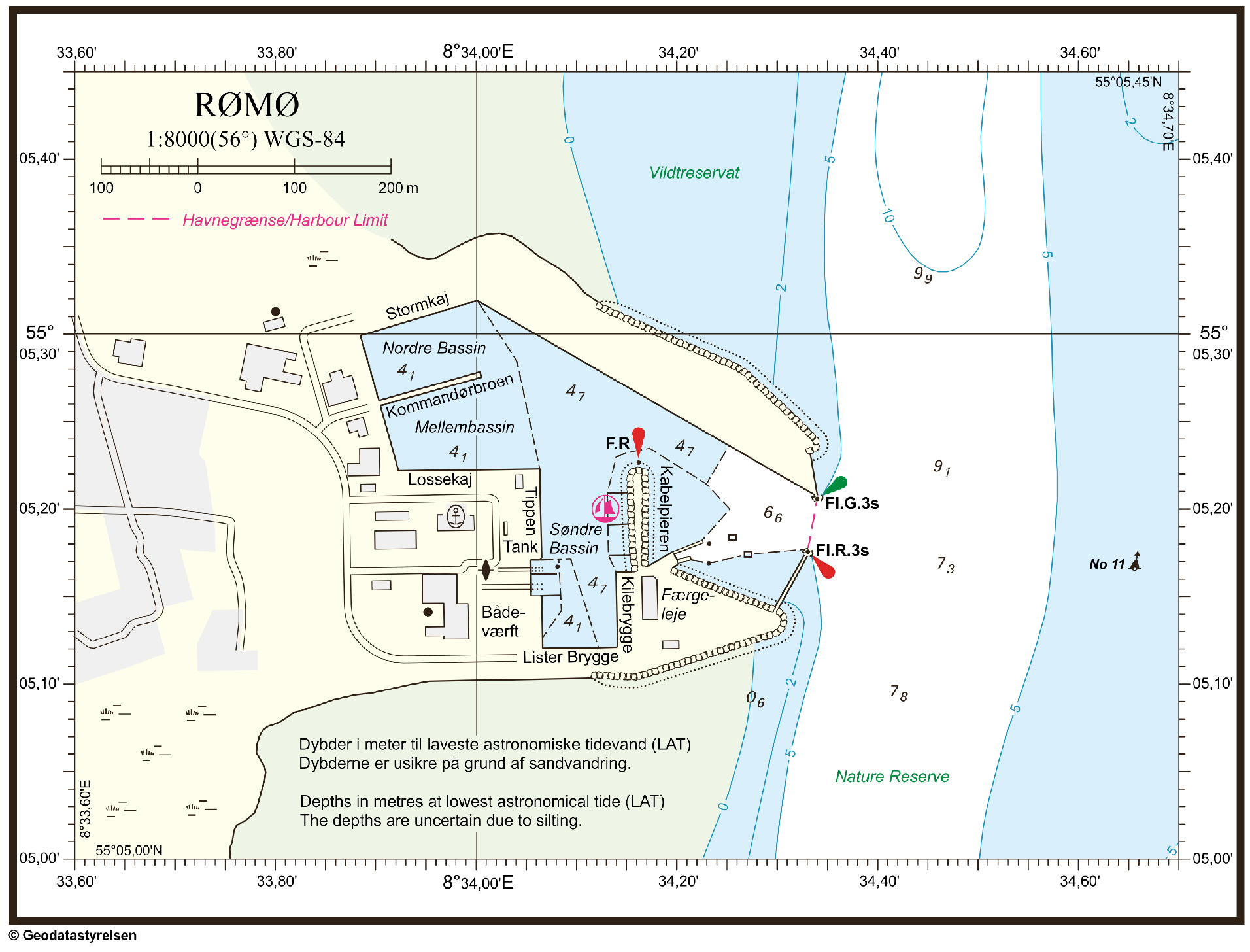
The port‘s geographical coordinates
The maritme area belonging to the port is limited by the port's quays as well as by straight lines through the following coordinates:
- 55°05,204°N
008°34,339°E, Northern pier head - 55°05,177°N
008°34,331°E, Southern pier head
Entry to the port
There are no special speed restrictions through the shipping channel. In Lister Dyb there is a sandbank, “Risten", which must be passed to get to Rømø Dyb. Risten is a dynamic area with an estimated water depth of around 5-6 meters. For further information refer to the current nautical chart and pilot service.
Pilots
There are no compulsory pilotage requirements for navigating into and out of the Port of Romo. At first entrance to the port, it is recommended that you use an experienced navigator with local knowledge of the shipping channel.
Tides
The tide swings approximately +/- 0.9 metres in relation to DVR90.
The tidal stream has a maximum speed of 2 knots. The stream runs across the port entrance.
Depth of water
- Along Nordkaj (North Quay) the water depth is 5 metres (average water level)
- In other basins the water depth is between 4.5 and 5 metres (average water level)

Restrictions
- The distance between the piers at the entrance to the port is 50 metres.
- length of vessel is approximately 140 metres
- width of vessel is approximately 35 metres
